Core Analytics
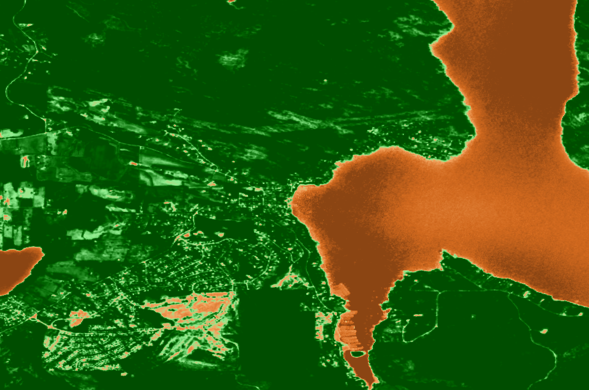
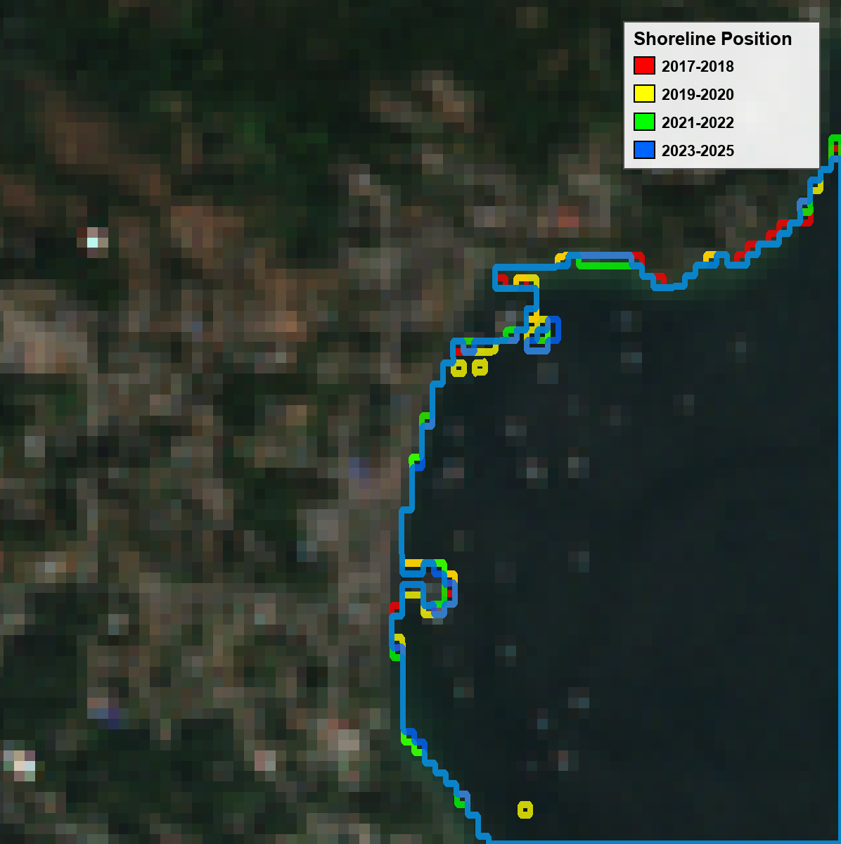
Shoreline Risk Proxy
Our proprietary metric analyzes 10 years of NDWI (Normalized Difference Water Index) data to identify unstable shorelines.
- Standard deviation analysis over 346+ sites
- Identifies erosion-prone areas
- Correlates with bluff composition
- Predictive accuracy: 37-44% for composition
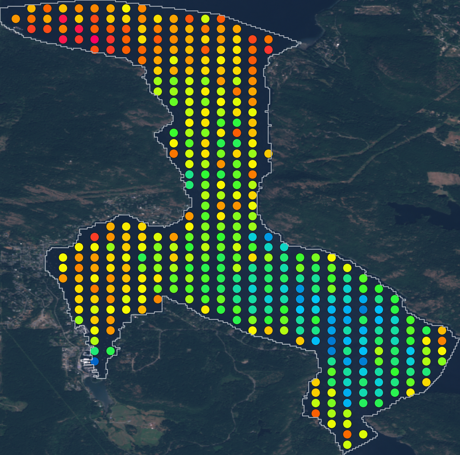
Algae Risk Assessment
Water-type-specific models predict algae conditions using satellite imagery and historical data.
- Rivers: Cyanobacteria prediction (R² = 0.69)
- Lakes: Chlorophyll-a forecasting (R² = 0.48-0.61)
- Coastal/Tidal: Water quality modeling
- Temperature and clarity analysis
- Real-time risk level classification
- 5-Year Temporal Animation: Animated GIF showing algae risk evolution with time slider
- Seasonal Video (MP4): High-quality 1-minute video showing weekly algae progression throughout the growing season (May-October)
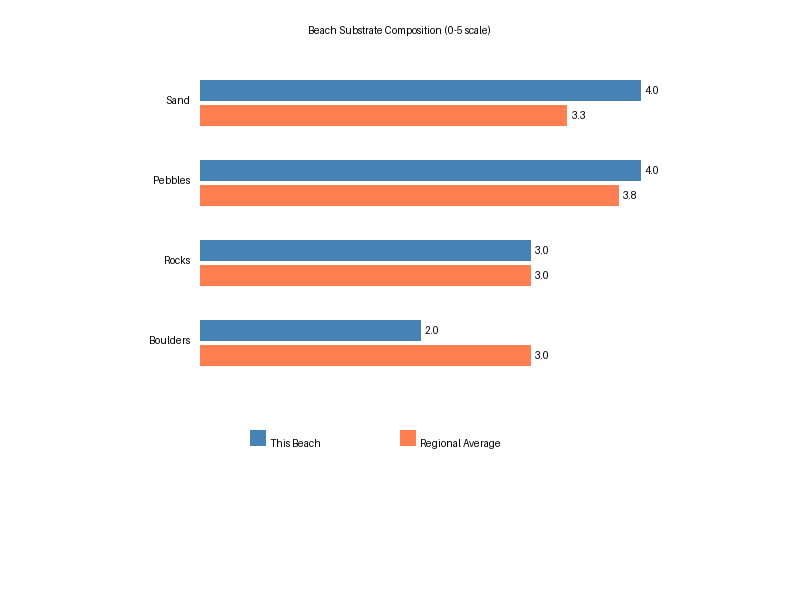
Beach Composition Mapping
Automated analysis of beach surface characteristics and geological features.
- Sediment classification (sand, pebbles, rocks, boulders)
- Bluff height and grade assessment
- Rock type identification
- Debris and vegetation indices
Biodiversity Tracking
Community-powered species identification and ecosystem health monitoring.
- AI-assisted flora and fauna identification
- Biodiversity score calculation
- Marine ecology indicators
- Species distribution mapping