Why
Terminal expansions, marinas, outfalls, dredging and coastal protection works all change a shoreline. Once the excavator arrives, what the beach looked like before is gone, and arguments about damage, restoration targets or compensation come down to whoever kept a record. The satellite part of this pack can be recomputed later; the human surveys and photos in it cannot be re-collected.
What's in a pack
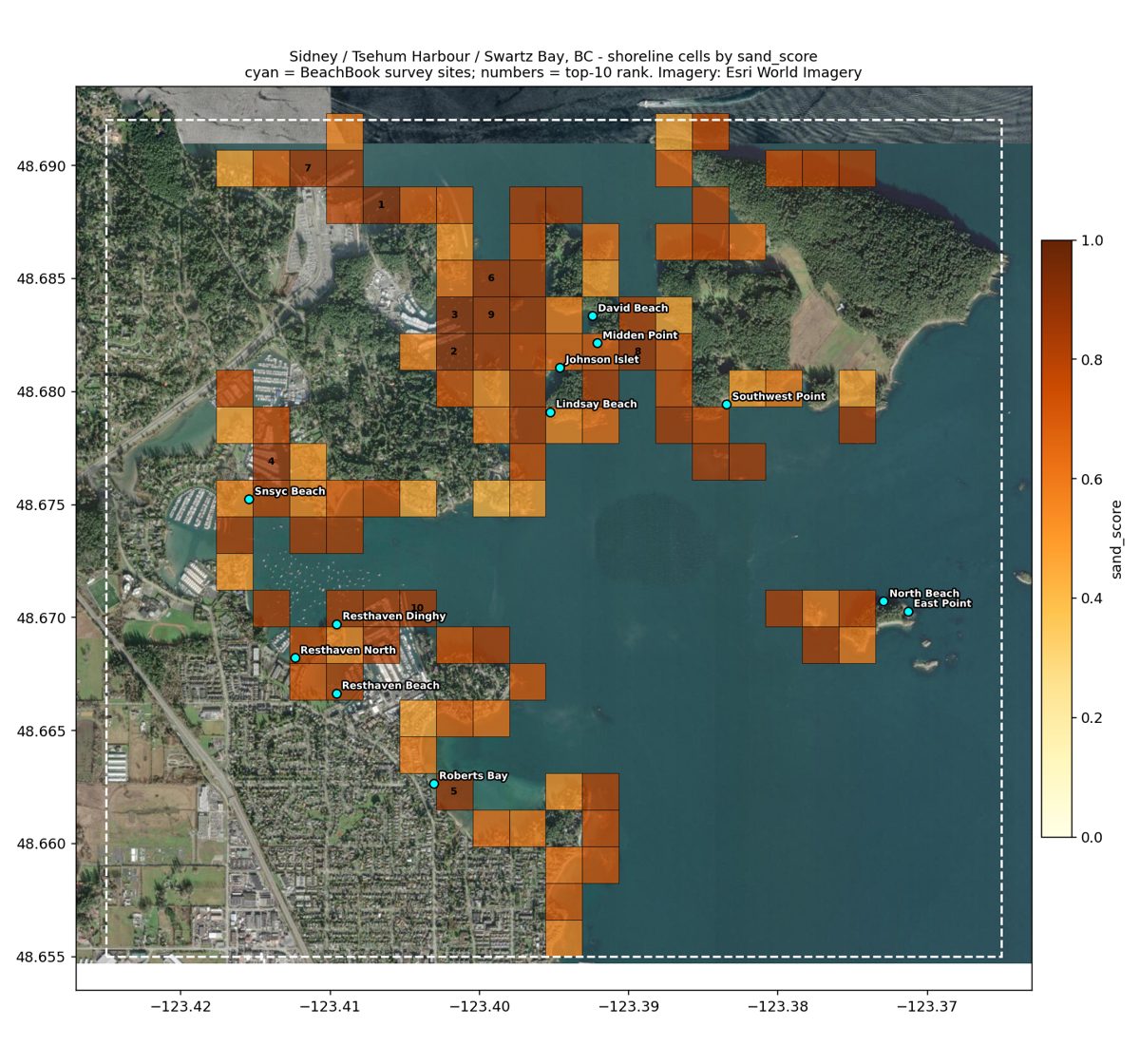
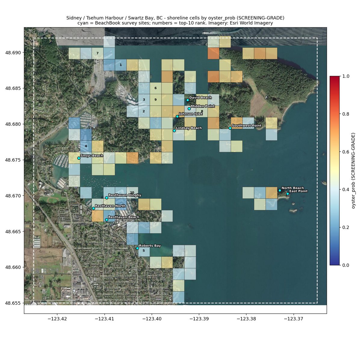
- Every shoreline cell in your area (~180 m squares on the waterline), scored from a Sentinel-2 composite and ranked: CSV + GeoJSON for QGIS/ArcGIS.
- Every BeachBook human survey inside the area: full answers (sand, rocks, logs, oysters, clams, garbage, access ...), aggregates and the original photos. Contributors anonymised.
- Provenance: exact Sentinel-2 scene IDs and dates, model file hashes, survey export timestamp.
- Maps of the cells over aerial imagery with survey sites marked.
- A dated README and a SHA-256 manifest with one pack hash that fixes every file. Change one byte anywhere and the hash no longer matches.
Read this before buying: what each number is worth
Same honesty rule as Territory View. Only one output is a calibrated model, and even it is weak.
| Field | Grade | What it can be used for |
|---|---|---|
sand | MODEL | Calibrated on 318 surveyed beaches, cross-validated R² ≈ 0.20. Good for ranking where the sandy shore is, not a measured sand percentage. |
rock_prob / sandiness | SCREENING-GRADE | Classifier, CV-AUC ≈ 0.69. Points at where to send a person. Not a substrate measurement. |
oyster_prob | SCREENING-GRADE | Tidal presence/absence classifier, CV-AUC ≈ 0.73 on 179 beaches. Habitat likelihood only. Not harvest-safety guidance and says nothing about DFO closures. |
| BeachBook surveys | Observations | What people recorded on the beach. Older records came over in a Sept 2025 database migration, so their saved date is the migration date; camera dates in photo filenames are given as hints. |
Built structures (ramps, docks, breakwaters) are not masked and can score as "sandy"; it shows on the map. Sentinel-2 is 10–20 m: nothing here resolves individual boulders or shell beds. Where your area has no BeachBook surveys, the pack says so; we don't invent them.
Free sample: Sidney / Tsehum Harbour / Swartz Bay, BC
18 km² around the Swartz Bay ferry terminal, Tsehum Harbour marinas and the Sidney waterfront. 108 shoreline cells, 12 surveyed beaches, 22 survey photos. Imagery: 8 Sentinel-2 scenes, Aug–Sep 2024. Packed 30 Sep 2026.
Download sample pack (ZIP, 12.6 MB) Read the README first
Sample pack hash (photos downscaled to 1600 px for download size; the originals' hashes are inside):
0bcfa0592706334fe1467d02df0795e0df22316a5601fec733866d71f20cfc02
Price
Per project area up to ~20 km² of BC coast, delivered within a week. Full-resolution survey photos, both maps, and the pack hash emailed to you separately on delivery day so the date is on record outside our servers. Larger areas or before/after re-runs of a pack you already hold: ask.
Send the area (a map screenshot, a bounding box, or a project name) and when works are expected to start. Contains modified Copernicus Sentinel data (ESA). Survey data: BeachBook community.